Showing posts with label Leadville. Show all posts

Saturday, January 22, 2011

Treeline Loop Snowshoe

Distance: 3 miles round trip
Elevation: 10, 407 ft
Elevation Gain: 630 ft (cumulative)

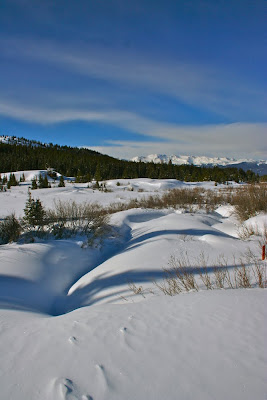
Typical Segment of the inner portion of both the Treeline Loop and Powerhound Loop

The Treeline Loop on Tennessee Pass near Leadville and Ski Cooper is not the most exciting trail but it sure is popular. Exceptionally well marked, blue diamonds and large wooden signs guide cross-country skiers and snowshoers through the loop options, which is good, because otherwise it would be very easy to get lost.

The Treeline Loop starts in the trees past the bathroom and comes out just out of view to the left of the photo.

The route starts on Tennessee Pass in a large parking lot directly across from the entrance to Ski Cooper. For this parking lot there are 4 possible routes. The Treeline Loop and the Powderhound Loop are the shortest and together form a very mushed numeral 8. The middle portion of the 8 is the same for both loops.

The first trail marker. Both the Treeline Loop and Powderhound share the inner portion.

You can take either loop in any direction, but we chose to start at the western end of parking lot. This segment is coincident with the Continental Divide Trail and a sign within 50 yards lists mileages to Copper Mountain Ski Resort to the north (23 miles), and Hagerman Tunnel (see summer hike to that area) to the south (14.9 miles). Shortly beyond this is another sign showing the turn for the Powderhound Loop continuing up the Continental Divide Trail and both the Treeline Loop and Powderhound heading up the middle. This is the direction we chose.

Coming into the open meadow at the top of the ridgeline

The initial portion of the trail is totally in the trees and winds east and west as the trees permit. This is the first trail I have been on where there was a separate track for skiers and snowshoers. I found this particularly tedious because the two tracks interwove continuously so we were constantly trudging back and forth.

The trail sign at the end of the middle portion (at 1.34 miles)

After 400 ft or so of elevation gain we came to the top of the ridge. Here there were a few open meadows but still no views. There were so many tracks that it took us a while to find a blue diamond and our route. Don't let the meadow bushwhacks fool you, there is another wooden trail sign at the apex of the 8 (at 1.34 miles) and you should persist along the ridge until you come to it.

There are a few more open areas on the lower portion of the Treeline Loop, but not many.

Our original intent had been to do the Powderhound Loop, but we were frankly so bored with the area that we wanted out of there as quickly as possible and so chose to head left on the shorter Treeline Loop.

The junction with the Continental Divide Trail (at 1.92 miles) indicating the Treeline Loop heading left. The back side of this sign says "Colorado Trail" and points to the right from this angle.

From this point the trail heads sharply downward through yet more trees until it reaches the other side of the Continental Divide Trail. This junction at 1.92 miles is also marked with a wooden sign. From this intersection the Treeline Loop heads left and back up to the parking area.

Don't get excited by this "peek-a-boo". It lasted for a couple of seconds and was the only one we saw.

Anyone who has read this blog for any length of time knows I don't like being in the trees. Whether hiking or snowshoeing I like the wide-open view. Having done the Bemrose Ski Circus off of Hoosier Pass near the Breckenridge Ski Resort the day prior, this trail seemed like a snore-fest. Don't let my jaded attitudes prevent you from trying it however. It is ideal for novices since it is relatively flat and well marked and it would be ideal on a day when the nefarious Leadville winds are blowing. If you are in the area and want something more challenging with better views, check out Vance's Cabin, the Lower Mosquito Pass Road or my all time favorite Mayflower Gulch near Copper Mountain.

Sunday, July 27, 2008

Summer Weekend In Leadville Part I: Walking off Dinner


Sunset over Turquoise Lake as seen from the west side of town

Once again a group of us are at the Leadville Hostel to hike, feed, and otherwise be entertained by the juxtaposition of toxic waste and stunning views that is Leadville.


You don't have to wander far to get off the pavement in Leadville. There are dirt roads everywhere that traverse the hills and sage.

As per usually Wild Bill made a scrumptious dinner fit to feed a peak bagger. Portion control is not my biggest virtue particularly where good food is concerned, so we took the dogs for a walk in the hills behind Leadville. It did not burn off dinner, it did make us feel better. The farther you wander the higher you go and the more stunning the views become.

Sunday, February 3, 2008

Leadville Weekend: Part 3: Leadville Hostel

View from parking lot of the Leadville Hostel

I want to take a moment to talk about the place we stayed in Leadville. I am not normally the hostel type. I like gourmet food, cushy feather pillows, and fawning service. Still I liked this place enough to book it for the last weekend in July. It was comfortable, homey, and perfect for a group outing. There are private rooms and bunkrooms with varying sleeping capacities.

There are multiple common rooms as well. The basement contains a roaring stove with couches galore and a pool table. Close to the stove, heat was intense so if you are a delicate summer flower or hothouse succulent, you will feel right at home. Upstairs is another living room with wrap around couches surrounding a large screen TV. Behind this is a comfy couch ensconced in a picture window with views of the mountains. It is much cooler there of course, which would make it the perfect respite for my mother, whom I call “Judy of the Tundra” because of her whacked out thermostat. I was not about to ask, but it seemed like several hot flash mamas were enjoying it as well. Wool blankets abound, however, if you want to enjoy the sun and view without drastically lowering your body temperature.

The owners, Wild Bill & Kathy, hail from the Delta region of Mississippi where straightforward hospitality combine with the passionate vocalizations and rhythmic guitars of Blues. Wild Bill came to Leadville to ski but his soul is still in South. The hostel is covered in Blues festival regalia and the strains of Snooky Pryor resound from the large kitchen. Given the chance he will talk your ear off with the history of both his homes. He had us all watch a video on the history of the 10th Mountain Division, which trained for WWII at nearby Camp Hale. His unconsciousness ease in a room full of strangers makes him the perfect hostel host. Cathy is quieter but equally pleasant.

There is bottomless tea and coffee (for a small donation) in the kitchen. You can bring your own food and store it neatly in a named box in the fridge or pay $10 for dinner and $5 for breakfast. We opted for the latter, which was great. We had pasta and salad one night and pork loin the next. After a hard days snowshoeing, it is pleasant to hang around a large table and feed with friends.


Just to be fair, not all was perfect. Our room was in the basement and it was profoundly noisy. A 20-person church group came in at 1:30 in the morning dragging god knows what down the wooden stairs. The kids were screaming and doors were slamming. They were up again at 6 am to go skiing. The noise was thunderous and the 3-person communal bathroom filled with dripping teenagers. The adults were apologetic later once they learned they were not the only people in the 40+ occupancy basement, but this quickly evaporated the next day when the departed at 6am dragging what sounded like coffins up and down the floor and up the stairs. Later I saw that they had been dragging large, industrial sized boxes up the stairs. Most of our party stayed in the bunkrooms on the main floor, which not only had their own bathroom, but were also insulated from the cacophony below. If you are a light sleeper, stay in one of those rooms.

If you like people, are on a budget, or are just in the mood for something different, give the Leadville Hostel a try.

Thursday, January 24, 2008

Lower Mosquito Pass Road Snowshoe

Distance: 3 miles round trip
Elevation: 10,900 ft -11,200 ft
Elevation gain: 300 ft

Looking east towards the Mosquito Range from our unnamed road.

On our last day in Leadville, we wanted a simple trail that we could explore in a couple of hours because we had to head back down to Denver and we were tired after our trip to Vance's Cabin the day before. Our host at the Leadville Hostel, told us to just head straight up CO Rd 3, pass under the bridge for the Mineral Belt trail, and park when the road ended. From there he said you could go in numerous directions. We decided to continue up Co Rd 3, which is lower Mosquito Pass Road.

The parking area where the road is no longer plowed

Co Rd 3 makes a sharp right turn and cross a drainage.

This route has fantastic views of the Continental Divide, mining ruins, and snowy hillsides so warm and fluffy we wanted to reach out and pet them. Add to this a “chamber of commerce” blue sky and you will understand why we love the mountains. There were two Brits staying with us at the Hostel who, despite their phenomenal exchange rate, had spent significantly more than we did to enjoy this Colorado experience.

Looking back down the drainage to the west

A little farther up the road

In short order the road circumnavigated a vast meadow filled with snow-covered mining ruins. From a distance these looked like dollhouses in a Santa Clause village. The mine tailings, undoubtedly guaranteed to ensure your sterility, were similarly transformed into fluffy hillocks behind which naughty elves plotted snowball ambushes.

All of the mounds are mine tailings

Is that Mt. Evans directly ahead?

At some point, we ended up veering off of Co Rd 3 onto an unnamed road heading west. There was so much snow in the area, and we were following a snowmobile track that it was not until later that I realized we were no longer on Mosquito Pass Road.

Cabin and tailings covered in snow

Ruins, ruins, everywhere

Eventually, time ran out on us but I have been told this western heading road continues for some distance with periodic views of the Collegiate Peaks. You won’t find this trip in any guidebook, but it is well worth doing on a clear day.

Heading west on our unnamed road

Turning around and heading back down

Someday I shall return and head further up Mosquito Pass Road. The views of Mount Massive to the west must be phenomenal.

Blue skies, Mt. Massive in the distance, and lots of happy snowshoers

Vance’s Cabin Snowshoe

Trail Length: 6 miles round trip
Elevation: 10, 550-11,120 ft
Elevation gain: 1,040 ft

Standing on the back of Vance's Cabin

A trip to Vance’s cabin is a moderate snowshoe out of Ski Cooper near Leadville with potentially spectacular views of nearby 14ers as well as the Continental Divide. On this trip unfortunately, most of the views were diluted with low hanging clouds but anyone. Since the cabin is well used in both winter and summer this is not a trail for total solitude although the intrusions are limited to the two-footed kind. Snowmobiles are prohibited.

From the Ski Cooper parking lot head up the side road to the obvious sign and take a left.

I was snowshoeing to Vance's Cabin because a group of 12 of us were in town for the MLK weekend. The group split into two groups, with a few of us going to Vance's Cabin and the rest to the 10th Mountain Hut, a much longer trip.

Leadville has the reputation for being one of the coldest places in Colorado and I was afraid that I would freeze my num-chucks off (they take six weeks to grow back) but the weather was relatively mild, so don’t let the forecasters scare you off with -30 wind chills.

After making the left at the sign, the route travels up a small drainage towards are large meadow.

Finding the trailhead is not difficult as long as you can manage to find highway 24 out of Leadville, since the trail starts at Ski Cooper, at the top of Tennessee Pass. From the Ski Cooper parking area there is a maintenance road heading east with a prominent red sign that reads “Vance’s Cabin” in 2000 pt font. Miss this and you should not venture outside of the nearest Starbucks.

Turning left (west) and heading up a large meadow.

The first half-mile of the trail is along a well-groomed road bordered on the left by a creek and the right by drifting banks. An equally prominent sign marks the next turn off. This one has a large arrow pointing to the left that made us hearty mountain folk roll our eyes. In the woods though, it is always useful to know where you are so disregard our condescension and be thankful for the good folks at Ski Cooper who are minimizing their search and rescue budget.

Approaching the far end of the meadow.

After this well-marked left turn, the trail crosses a creek and heads up a wide valley. Mid-way up the trail turns sharply upwards to the left and climbs 300 feet. At the top are two large meadows that are perfect for power hopping. I would have killed for a clear day because this spot must contains some lovely views to the east.

After the meadow, the trail spends a part of time in the trees.

After the meadows the trail continues for 1.5 miles through the trees. Usually I find this sort of thing monotonous but today there was so much snow on the trees that the trail really was winter wonderland. Modern art sculptures abounded as the copious “snow blobs” transformed both tree and stump into mythical creatures.

The final pitch to the cabin is down a broad slope.

The trees end at the highest point of the trail, which resides at 11,300 ft. From here you must descend down a broad slope to the cabin. The slope is dotted with the burnt out remnants of a long forgotten fire. To tell you the truth, I did not notice these until the return trip because I was having too much fun bounding down the hill in a blur of “we’re almost there” frenzy.


The interior of Vance's Cabin

Vance’s cabin itself is the smallest hut in the 10th Mountain Division’s hut system. It was being occupied by half of Denver’s EPA office that kindly let us in to scope things out. I have never stayed in a hut since I can’t imagine having to carry enough gourmet food on my back to keep me happy for three days. One of these days I need to try it though.